Connecting the Connecticut: Partners team up to develop a roadmap for conserving the Connecticut River watershed
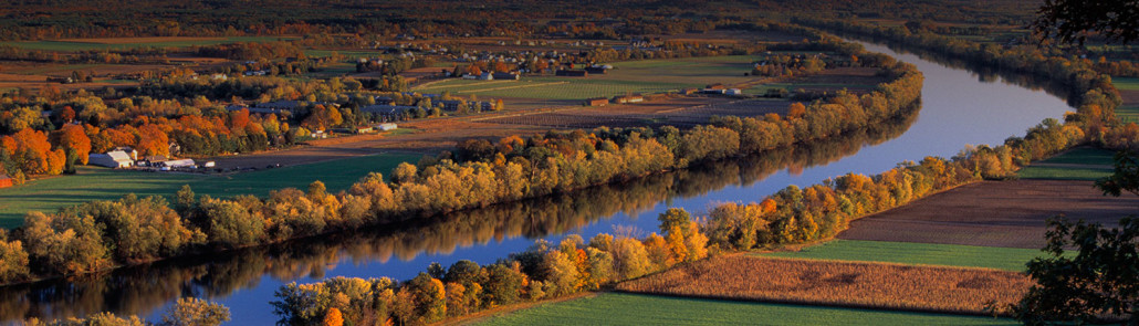
Encompassing New England’s largest river system, the Connecticut River watershed provides important habitat for a diversity of fish, wildlife and plants from such well-known species as bald eagle and black bear to threatened and endangered species such as piping plover and dwarf wedgemussel.
The watershed is also a source of clean water, recreation, food, jobs and more for millions of people living in Vermont, New Hampshire, Massachusetts and Connecticut.
The best long-term strategy for sustaining natural resources across this kind of large landscape is to keep vital parts of it intact and connected. Connect the Connecticut is a collaborative effort to identify the best places to start—the areas within the watershed that partners agree should be priorities to ensure that important species, habitats and natural processes will be sustained into the future, even in the face of climate and land use change.
“This is truly a groundbreaking effort, building on a long history of collaborative conservation in the watershed,” says Ken Elowe, a former state wildlife agency director in Maine who now heads the U.S. Fish and Wildlife Service’s science applications program in the Northeast Region.
“For the first time, we have the science capability to pinpoint habitat needs — what kind, how much and where — to sustain fish and wildlife species at desired population levels across a large area like the Connecticut River watershed,” Elowe says. “And we will know how the watershed contributes to broader species and habitat goals for the entire Northeast.”
Using the best available science and information from the North Atlantic Landscape Conservation Cooperative (LCC), a team of more than 20 partners representing different state and federal agencies, academic institutions, and private organizations spent more than a year creating a conservation “design” for the watershed. Outlining a network of core areas, or intact, connected and resilient places within the watershed, the design serves as a roadmap for conservation.
The effort also featured an innovative modeling approach developed by the Designing Sustainable Landscapes Project at the University of Massachusetts Amherst.
One of the keys to developing the Connect the Connecticut design was selecting 15 species as representatives for others that rely on similar habitats within the major types of natural systems in the watershed.
For example, the blackburnian warbler was selected to represent hardwood forests. By ensuring that high-quality habitat for these representative species was included in the design, the partners were able to address the needs of a range of fish and wildlife.
More than just a map, the conservation design includes a variety of datasets and tools that people from all sectors can access to make more informed decisions about managing lands and waters that provide habitat for wildlife, and support local economies and the overall health and well-being of communities.
“These products are useful because we know there is a tremendous amount of data that has been analyzed and collected in one place, and that it is oriented toward shared priorities,” says Andrew Fisk, Executive Director of the Connecticut River Watershed Council. “There are so many wells to dip into for information, so the fact that this is comprehensive and comprehensible to those who are not power users of data is really important.”
Connect the Connecticut is intended to help resource managers, planners, and others prioritize effective conservation actions, and adjust course as needed to achieve meaningful and measurable conservation results. The tools and information complement local knowledge by offering broader state, regional, and national context to help sustain important natural resources across large regions in an era of accelerated change.
“If you are working locally, you should know what’s going on regionally – where there is going to be energy for conservation,” says Bill Labich, regional conservationist with Highstead Foundation.
Labich, Fisk and other partners are now testing the design and exploring potential applications with their agencies and organizations. Information and lessons learned from the landscape conservation design process will be used to refine the products over time, and can be applied in other geographies throughout the Northeast.


