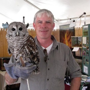
Town of Palmer

Angela Panaccione

Conservation Agent, Town of Palmer, Massachusetts

Angela-Panaccione-photo

Conservation goals
We manage about 800 acres of conservation land in Palmer, and we have a strong wetlands protection ordinance that goes beyond even state regulations. Palmer is at the confluence of four major rivers, and the heart of the largest watershed within the state, the Chicopee watershed, so we are committed to maintaining the integrity of cold water habitat.

How Connect the Connecticut connects
By connecting our local objectives to regional objectives, and using a shared framework to promote collaboration across federal, state, and local conservation networks, we can help increase resilience and ecological integrity of the larger landscape. This is especially important now with the effects of climate change. If you can propose an action that will not only protect your land, but will protect everyone around you and increase quality of life into the future, that is much more meaningful.

How it will inform work on the ground
A lot of times when discussing land protection options with property owners, the question I get is: If I protect my land permanently, what will that mean 100 years from now when everything is different? This tool helps us show them why their parcel is ecologically valuable in the grand scheme of things. It’s not always useful to talk about specific species with a landowner, unless they happen to be interested in that animal, but this map provides a way to show that land is going to continue to be ecologically important for a variety of reasons, and that by preserving it now, you are making sure climate change won’t impact its value.

These tools give us more resources as land managers to effectively achieve action items within our open space and conservation plans, and to justify these actions within a regional framework for keeping our shared resources resilient.

Example applications
I used the design to convince our Town Council to request special enabling legislation from the state senate to direct the transfer of a 92-acre parcel from MassDOT to the Palmer Conservation Commission. The parcel was taken by eminent domain in the 1960’s when I-90 was under construction, and the Conservation Commission has been trying to acquire it back since 1980. With data from Connect the Connecticut and Mass Audubon’s Conservation MAPPR tool, I was able to show our Town Council and State Senator Ann Gobi the ecological significance of this parcel on the landscape level.

The parcel contains a significant portion of Kings Brook, a cold water fisheries resource, headwater to the Quaboag River and a designated priority habitat for endangered species. It would also provide a continuous protected corridor (of over 2,000 acres) from the Mass Pike to the Palmer/Ware town line, as it directly connects to other town conservation land and fish and wildlife land as well. Sen. Gobi agreed to sign off on enabling legislation for the transfer of the parcel, and presented the bill at a public hearing in Boston in June.

I also used the data and mapping tool to apply for a grant to replace a culvert that represented a significant barrier to fish and wildlife migration, and cuts off two core areas with high Index of Ecological Integrity values. The crossing is on Kings Brook, the same headwater stream we are trying to protect by acquiring the turnpike parcel.

Additional information and resources

Massachusetts Division of Fisheries and Wildlife

David Paulson

Endangered Species Review Biologist, Massachusetts Division of Fisheries and Wildlife Natural Heritage and Endangered Species Program

Conservation goals:
Massachusetts has a rich biological legacy and is home to a wide array of plants and animals. It is the Division’s mandate to conserve and manage these natural resources. The Natural Heritage and Endangered Species Program is responsible for the conservation and protection of hundreds of non-game species in the state. The Program’s highest priority is protecting the Commonwealth’s rare vertebrate and invertebrate animals and native plants.david-paulson

How Connect the Connecticut connects:
Understanding all of the conservation partners in the region and how they operate helps us all leverage scarce resources. When you bring together a whole range of people who are thinking about regional conservation, you start to develop valuable networks and relationships. But if you want to actually get people working together, thinking across state lines, and leveraging resources, you need to have the best possible data available. This project does both.

How it will inform work on the ground:
With limited resources and staff, you have to maximize every opportunity and utilize available conservation tools. So this is another tool in our toolkit. It can help us tell a compelling story to justify why we are focusing on certain area. The more reasons you can give to say a particular area is important, the stronger the case you can make to funders and to staff during internal review. Particularly in areas where there is an absence of data, we will use Connect the Connecticut as our first cut to get a sense of what could be there.

When you make connections between different conservation partners and identify shared goals, you create a potential for greater conservation outcomes.

Example applications:
The Terrestrial Core-Connector Network is a useful model for looking at longer term, landscape level questions, such as the movement of larger mammals that have broad ranges. We will share this information with our state transportation partners, compare it with road kill and connection data that shows wildlife crossings and use the network for a post-hoc analysis by overlaying specific long- or short-term projects.

We are also very interested in the landscape capability models for representative species for rare species mapping. For example, the Wood Turtle Landscape Capability map is consistent with what we already have mapped for this species, and can be used to identify areas that we might not have previously surveyed.

Additional information and resources:

Audubon Connecticut

Patrick Comins

Director of Bird Conservation, Audubon Connecticut; President, Friends of the Silvio O. Conte National Fish and Wildlife Refuge

Conservation goalsPatrick-Comins-photo
Connecticut Audubon is a bird organization, so that’s where our primary interest lies, but we are concerned with protecting a variety of wildlife and their habitats through education, research, advocacy and land protection. Through our Important Bird Areas Program, we have identified a network of more than 30 key areas for birds, and we works with landowners, government agencies, and other conservation organizations to restore and protect important bird habitats statewide.

How Connect the Connecticut connects
It’s certainly valuable to have a holistic approach that is also objective so you can better justify why particular areas may be more important than others. Audubon’s own focal areas are derived through processes similar to Connect the Connecticut, but our areas are more selective for birds. We plan to use a combination of the two because it will be useful to have different tiers of information.

How it will inform work on the ground
The design will be be a very useful prioritization tool for us. The representative species models are particularly important, as they give us some predictive ability to determine where our focal species occur. We can’t always get to a site in the breeding season, even if there are species of greatest conservation need present. So the models help get us there.

It’s certainly valuable to have a holistic approach that is also objective so you can better justify why particular areas may be more important than others.

While there are some state important areas that don’t show up in the design, it does cover habitats that we did not previously have within our priority areas. For example, freshwater wetlands. So in those case, we would probably take the design at face value.

Example applications
Audubon Connecticut has partnered with the U.S. Army Corps of Engineers for an initiative called the In Lieu Fee Program, established to provide funding for the restoration, enhancement, and preservation of aquatic habitats and upland buffers in the state. The program receives funding from application fees paid to the U.S. Army Corps of Engineers for development projects that impact wetlands and watercourses, and Audubon Connecticut works with local, state, and national partners to select and fund large-scale mitigation projects including land acquisition.

For our role deciding when to give to partners additional resources role in the granting process, the Terrestrial Core-Connector Network will be a good lens to evaluation the potential distribution of the funds along with our Important Bird Areas.

Additional information and resources

U.S. Fish and Wildlife Service

Georgia Basso

Wildlife Biologist & Liaison to the EPA Long Island Sound Study, U.S. Fish & Wildlife Service, Coastal Program

Conservation goals
The Environmental Protection Agency (EPA) Long Island Sound Study is a cooperative bi-state effort to protect the Sound by focusing on hypoxia, habitat restoration, public involvement and education, and water quality monitoring. I co-chair the habitat restoration and land protection work groups. These groups are often involved in decisions regarding the where, when, and how of habitat restoration and protection around Long Island Sound.

georgia-basso

How Connect the Connecticut connects
Connect the Connecticut helps us to be much more strategic in decisions related to habitat restoration and land acquisition. The tool provides a landscape-scale perspective that we did not have before. It can help us prioritize limited dollars in an ecologically important area where it is expensive to do work.

How it will inform work on the ground
We often make decisions about where to focus restoration dollars. We recently completed a habitat quality assessment looking at the health of rivers, grasslands, forests, wetlands, and embayments within the Connecticut portion of the Long Island Sound coastal boundary. One of the biggest challenges these habitats face is urban pressure. Forests, for example, face issues such as fragmentation.

This tool shows quantifiably where the highest quality forests are located. Coupled with what we already know about this region, the tool helps us identify where increasing connectivity could have the greatest impact.

It is highly beneficial to have a tool that operates on a landscape scale and across a region as diverse as the Connecticut River watershed. Tools like this not only help us think about functionality and integrity at an ecosystem scale, but give us the ability to strategically improve these aspects across the landscape.

Example applications
The Terrestrial Core-Connector Network can be used to identify high-value value corridors. This application can guide acquisition and restoration decisions that will help restore the integrity of habitats at a landscape scale.

We will also direct our partners to the Culvert Upgrade Impacts and Dam Removal Impacts layers. The EPA Long Island Sound Study helps to manage the National Fish and Wildlife Foundation Future Fund grant every year. This grant provides approximately $1.2 million for a diversity of projects, including habitat restoration and dam removal work. Connect the Connecticut offers another layer of information that can help the review team select the highest priority projects.

Another asset to the Long Island Sound Study and our partners is the Probability of Development layer. The Long Island Sound Study designates 33 stewardship sites around the Sound — lands of high ecological, recreational, and scientific significance. They include National Wildlife Refuges and other protected areas. Probability of Development helps us more clearly understand how intense the pressures are around these sites, and better allocate resources to protect them in a variety of ways, such as increasing buffers and working with surrounding landowners to minimize negative ecological impacts.

Additional information and resources

Connecticut River Conservancy

Andrew Fisk

Executive Director, Connecticut River Conservancy

Conservation goals
The Connecticut River Conservancy is working toward ambitious and consistent water quality goals for the entire Connecticut River watershed, and trying to erase differences in expectations for restoring and maintaining the biological integrity of our water across state boundaries. andrew-fisk

How Connect the Connecticut connects
We recognize from the perspective of the Conservancy that we have very high expectations for our water. Everybody owns the water, everybody owns the fish, and we have a really high expectations for what we want the watershed to become. That requires a whole lot of really good scientific and technical information so we know where to put our resources. From our vantage point a project like this is very helpful because it pulls the best science together, and has the best people evaluate it, make decisions about the information, and then ideally that leaves us a tool that allows us to say: These are our broad goals, this is where we want to make them manifest.

How it will inform work on the ground
We will be using the science products from Connect the Connecticut for scoping projects and identifying priorities. In terms of restoration work, we focus on culvert replacements, riparian habitat restoration, invasive plant removal, reintroduction of native species, dam removal, and more. So these tools are useful in a general sense because we know there is a tremendous amount of data that has been analyzed and collected in one place, and that it is oriented towards shared priorities. There are so many wells to dip into for information, so the fact that this is comprehensive and comprehensible to those who are not power users of data is really important.

There are so many wells to dip into for information, so the fact that this is comprehensive and comprehensible to those who are not power users of data is really valuable.

Example applications
The Connecticut River Conservancy is one of seven partners – including Highstead Foundation – that have received funding from a $10 million federal grant from the USDA Regional Conservation Partners Program (RCPP) to reduce agricultural runoff into the Sound. Although a cleanup plan for Long Island Sound has been mapped out for at least 10 years, there is this pending question about upstream responsibility. With point-source dischargers, you can do limited technological or effluent reductions. But what about nonpoint sources?

The partners in the Long Island Sound RCCP are working together to identify the best opportunities for sediment and nutrient reductions in the Connecticut River watershed – which drains into Long Island Sound. But we also want to overlay the Terrestrial Core-Connector Network to determine where those opportunities coincide with high quality habitat. The hope is that we can get multiple benefits – both habitat and restoration – from each project.

Additional information and resources

Highstead Foundation

Bill Labich

Regional Conservationist, Highstead Foundation

Conservation goals
The Highstead Foundation supports the Wildlands and Woodlands vision, which is for 70 percent of New England’s forested landscape to remain undeveloped wildlands where natural processes can occur without intervention.bill-labich It’s not about where this will and won’t happen, rather, we work through regional partners, called Regional Conservation Partnerships (RCPs), to build capacity to get the work done across the region.

How Connect the Connecticut connects
We want to see people work together in the areas that make the most sense. It’s about relationship building, but towards getting work done. There can be a big difference between a plan and what happens on the ground, but to have a guide that says, this is what a group of federal agencies, states, and NGOs agreed made the most sense, is huge. If you are working locally, you should know what is going on regionally – where there is going to be energy for conservation.

How it will inform work on the ground
We want to use the design to catalyze conservation. Everybody has their own priorities and activities. The only way you can engage them to do something new is to attach opportunity to it. This is a way to show complementarity.

For Regional Conservation Partnerships to be effective, they have to do several things at the same time: coordinate within their territory and with neighboring RCPs, communicate what is happening at the local scale, and be able to see where they fit into the bigger picture. But until recently, it felt like there wasn’t an overall vision beyond what individual states wanted to do.

If you are working locally, you should know what’s going on regionally – where there is going to be energy for conservation.

This design offers that bigger picture, and the data allows both RCPs and individuals to figure out where they can link into it. So now they can ask: We have this design, now what can we do with this information? What corridors are already being worked on, and how can we contribute? We couldn’t ask that question before.

Example applications
Highstead is one of seven partners – including the Connecticut River Watershed Council – that have received funding from a $10 million federal grant from the USDA Regional Conservation Partners Program (RCPP) to reduce agricultural runoff into the Sound. For the Long Island Sound RCPP, we are figuring out what parcels will be eligible, what proves that a piece of land contains habitat that can support rare, threatened, and endangered species.

While many RCPs have strategic conservation plans that address these questions, not all of them do. So in areas of the Long Island Sound watershed that overlap with the Connecticut River watershed, we want to lean on the design for RCP areas that don’t have a plan as the large landscape strategic conservation network that diverse partners are promoting and using. The data from the design would help us identify the best prospective parcels for the RCPP.

Additional information and resources

University of Massachusetts Amherst

Scott Jackson

Extension Professor, University of Massachusetts Amherst;
Coordinator, North Atlantic Aquatic Connectivity Collaborative

Conservation goals
The North Atlantic Aquatic Connectivity Collaborative (NAACC) was created to take advantage of all the players in region that have an interest in restoring river and stream networks and supporting healthy fish and wildlife populations in the long term. The first step is data collection, but it doesn’t stop there. We want to look at the nexus between connectivity, infrastructure, and public safety, to understand economic and policy aspects, and to really become a forum for people to work together to try and interconnect these systems before it is too late.scott-jackson

How Connect the Connecticut connects
When I look at distribution of road-stream crossings and dams across the region, I am shocked by the degree of fragmentation. Ecologically speaking, you only have so long to reconnect these systems. We have the opportunity to do that now, and we need people to work together and be as efficient as possible. That’s where components of the Connect the Connecticut will help.

Our priority is interconnection, and understanding the quality of habitat and degree of aquatic connectedness gives us a sense of connectivity. This information is key for us, and now we have the capacity to look at these factors over large scales.

As the landscape changes, thinking changes, and priorities change, the core components of this model can continue to be run and provide updated information for planning and action at the state, regional, and local levels.

How it will inform work on the ground

What’s great about the design is that it seeks to implement basic conservation rules of thumb to inform decisionmaking and planning, which is difficult to do in a large, complex landscape. With the power of computing, you can do more sophisticated, and comprehensive analysis, including every structure, dam, and crossing. You can evaluate every cell of the landscape, rather than just outlining polygons and saying: We want to protect what’s inside.

Beyond the actual design, I think the long term value is that as the landscape changes, thinking changes, and priorities change, the core components of the model can continue to be run and provide updated information for planning and action at state, regional, and local levels.

Example applications
The data that we collect as part of the NAACC are incorporated into Conservation Assessment and Prioritization System (CAPS) and Critical Linkages – models that are also part of Connect the Connecticut. So it’s a hand in glove relationship.

Among these elements are a prioritization of subwatersheds that are good candidates for assessments, and linkages that identify the highest priorities for assessments. We can start with the ones that are likely to have biggest impact ecologically, so right from the outset, we are using components of the design to target work. That is the greatest strength.

Additional information and resources