
A shared strategy for conserving the Connecticut River watershed
Encompassing New England’s largest river system, the Connecticut River watershed provides important habitat for a diversity of fish, wildlife and plants — from iconic species like bald eagle and black bear to federally threatened and endangered species like shortnose sturgeon, piping plover, and dwarf wedgemussel. For the millions of people living in Vermont, New Hampshire, Massachusetts, and Connecticut, the watershed is a source of clean water, recreation, food, jobs, and more. As the defining geography for the Silvio O. Conte National Fish and Wildlife Refuge, it is part of a national network of areas considered to have special significance for conservation.
Thanks to strong partnerships and pioneering research, the watershed region is also the perfect geography to pioneer an innovative approach to large-scale conservation: landscape conservation design.
The best places to start
The most effective long-term strategy for sustaining natural resources across a large landscape like the Connecticut River watershed is to keep important parts of it intact and connected. The landscape conservation design approach uses geospatial data, biological information, and models to identify opportunities to protect species, habitats, and environmental processes across an entire landscape. A completed design can offer guidance for organizations and agencies working at different scales in the same area, and can help foster collaboration among them to achieve shared conservation goals.
Connect the Connecticut is a partnership effort to create a landscape conservation design for the Connecticut River watershed that provides a roadmap for identifying the best starting places for conservation — areas that partners agree should be priorities in order to ensure that important species, habitats, and natural processes will be sustained into the future, even in the face of climate and land-use change.
Mapping the future of conservation
When the Connect the Connecticut project began, the sophisticated multi-species modeling tools and habitat data layers that were used to create the design were more developed for this particular watershed than for anywhere else in the Northeast region.
Protecting fish, wildlife, and natural systems
Using an innovative modeling approach developed by the Designing Sustainable Landscapes (DSL) project at the University of Massachusetts Amherst, and the best available regional science from the North Atlantic Landscape Conservation Cooperative (North Atlantic LCC), The Nature Conservancy (TNC), and the U.S. Geological Survey (USGS), a team of more than 30 partners from state and federal agencies and non-governmental organizations spent more than a year outlining a network of core areas — intact, connected, and resilient places within the watershed that provide the foundation for the landscape conservation design. The final product includes a variety of datasets and tools people from all sectors can use to make more informed decisions about managing lands and waters that provide habitat for wildlife, and support local economies and the overall health and well-being of communities.
In order to address shared goals and objectives for protecting species and ecosystems, the partners prioritized locations that contain high quality habitat for a set of 15 fish and wildlife species — including American woodcock, black bear, and Eastern brook trout — in delineating the network of core areas. The partnership identified these species to represent others that rely on similar habitats within the major types of natural systems in the watershed — from spruce-fir forests to small streams to freshwater marshes. Setting specific objectives for each of these species ensures that enough high quality habitat is included in the design, and that it reflects the needs of a range of fish and wildlife. Other key components of the core areas include high quality, resilient locations of both rare and common ecosystem types throughout the watershed, from Long Island Sound to the peaks of the White Mountains.
Meaningful, measurable results
Connect the Connecticut is intended to help resource managers, planners, and others prioritize effective conservation actions, and adjust course as needed to achieve meaningful and measurable conservation results. The data and tools complement local knowledge by offering broader state, regional, and national context to help sustain important natural resources across large regions in an era of accelerated change.
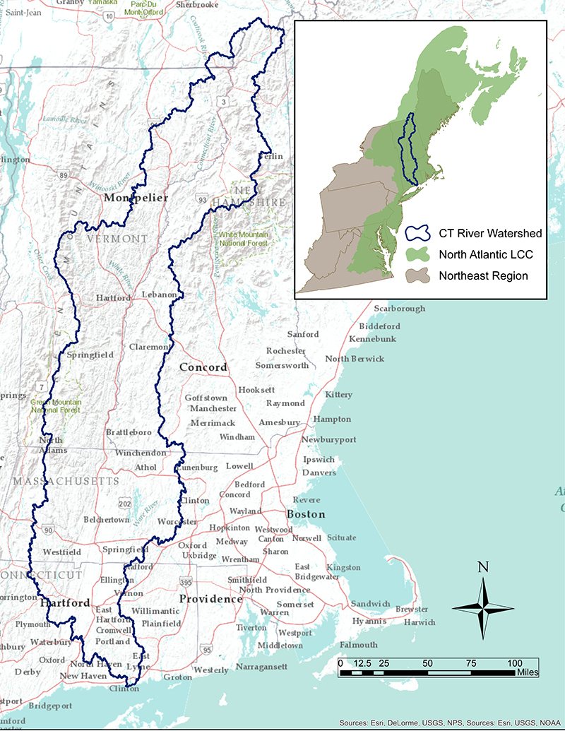
The Connect the Connecticut project identifies the best starting places for conservation within the Connecticut River watershed, which is also the defining boundary of the Silvio O. Conte National Wildlife Refuge.
What is a landscape conservation design?
Combining geospatial data, biological information, and models, a landscape conservation design identifies opportunities to protect species, habitats, and environmental processes across an entire landscape. A design can offer guidance for organizations and agencies working at different scales in the same area, and can help foster collaboration among them to achieve shared conservation goals.
What are the project goals?
The development of a landscape conservation design for the Connecticut River watershed was driven by two overarching goals agreed upon by the partnership
To sustain a diverse suite of intact, connected, and resilient ecosystems that provide important ecological functions and services that benefit society, such as clean water, flood protection, and lands for farming, forestry, and recreation.
